


- About
-
Upazila Parishad
Upazila Parishad meeting minutes
-
উপজেলা পরিষদের ২০২৪-২০২৫ অর্থ বছরের মাসিক সভার কার্যবিবরণী
-
Minutes of the monthly meeting of the Upazila Parishad for the financial year 2021-2022
-
Minutes of the monthly meeting of the Upazila Parishad for the financial year 2022-2023
-
Minutes of the monthly meeting of the Upazila Parishad for the financial year 2023-2024
Upazila Parishad Five Year Plan
Upazila Parishad committee meeting
-
Committee on Law and Order
-
Development of communication and physical infrastructure
-
Agriculture and Irrigation
-
Secondary and Madrasa Education
-
Primary and mass education
-
স্বাস্থ্য ও পরিবার কল্যাণ
-
Youth and Sports Development
-
Women and Child Development
-
social service
-
freedom fighter
-
Fisheries and Livestock
-
Rural Development and Cooperatives
-
culture
-
Forests and environment
-
Market price observation, monitoring and regulation
-
Finance, budgeting, planning and local resource mobilization
-
Public health, sanitation and clean drinking water supply
-
উপজেলা পরিষদের ২০২৪-২০২৫ অর্থ বছরের মাসিক সভার কার্যবিবরণী
- Administration
- Municipality
- Govt. Offices
- Different Institutions
- E-Service
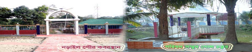
- Gallery
-
About
Upazila Introduction
History-Tradition
Geographical and Economic
Other
-
Upazila Parishad
Functions of Upazila Parishad
Upazila Parishad Chairman
Upazila Parishad meeting minutes
- উপজেলা পরিষদের ২০২৪-২০২৫ অর্থ বছরের মাসিক সভার কার্যবিবরণী
- Minutes of the monthly meeting of the Upazila Parishad for the financial year 2021-2022
- Minutes of the monthly meeting of the Upazila Parishad for the financial year 2022-2023
- Minutes of the monthly meeting of the Upazila Parishad for the financial year 2023-2024
Upazila Parishad budget
Upazila Parishad Five Year Plan
Annual Report (ADP, Development and Revenue
Annual Development Plan
Annual Financial Statements
Upazila Parishad committee meeting
- Committee on Law and Order
- Development of communication and physical infrastructure
- Agriculture and Irrigation
- Secondary and Madrasa Education
- Primary and mass education
- স্বাস্থ্য ও পরিবার কল্যাণ
- Youth and Sports Development
- Women and Child Development
- social service
- freedom fighter
- Fisheries and Livestock
- Rural Development and Cooperatives
- culture
- Forests and environment
- Market price observation, monitoring and regulation
- Finance, budgeting, planning and local resource mobilization
- Public health, sanitation and clean drinking water supply
Asset Statement (Register)
Citizen Charter of Upazila porishad
-
Administration
Upazila Nirbahi Officer
কর্মচারীবৃন্দ
About the organization
Services and other
-
Municipality
At one glance, Narail Municipality
Activities
-
Govt. Offices
Law and order matters
Engineering and communication
Health and family planning
Agriculture and food related issues
Education related
About Human Resources Development
-
Different Institutions
Educational Institution
Marriage Registrars List
Private companies
- E-Service
- Gallery
General information
District
Narail.
Upazila
Narail Sadar.
Upazila Parishad
Narail Sadar Upazila Parishad.
Police Station Police Station
Narail Sadar thana (Mahishkhola).
Investigation Center (IC)
2. (Sheikhhati and Biswadi).
Police outpost
01 (Kurigram).
Fire station
01 (Aladatpur).
Narail Sadar Police Station / Subdivision Headquarters
1861 AD.
Narail sadar upazila formation
1984 AD.
Geographic / administrative part
Union
13
Municipality
01.
Mouza
182.
Village
231
Geographical location
Narail sadar is situated 23 ° 02' and 23 ° 17' north latitudes and 89223˝ and 89˙37˝ east longitude.
Borders
Mohammadpur and Shalikha upazilas on the north, Magura. Lohagora upazila, Narail before Kaliya upazila on the south, Narail and Abhaynagar upazilas, Jessore and Baghparpara upazila on the west, Jessore
Volume
381.76 sq km *
Total population *
272,872 people
Ladies
137865 people
Male
13,5007 people
Population growth rate (annual)
0.13%
Religion based population *
Muslim
198573 people
Hindu
73913 people
Christian
205 people
Buddhists
0 people
Other
179 people
Total dhan / family number *
6,795.
Female Male Ratio *
98: 100
Population / sq km *
715 people
Education Information
literacy rate*
Total
65.5%
Women
62.7%
Male
68.4%
Government college
2.
Technical Training Center
01 (waiting for the start of the program).
PTI
01 (waiting for the start of the program).
Narail Government Technical School and College
01.
Government high school
2.
Private High School
42
Private low-secondary school
20.
Government primary school
98
Registered primary school
71 (publicly declared)
Community Primary School
04
Dakhil Madrasa
13
Alim Madrasa
03
Fazil Madrasa
01.
Alim Madrasa
01.
Qawmi Madrasah
12
Land information
Mouza
182.
Municipal land office
01.
Union Land Office
13
Sub-Registry Office
01 (Narail Gossip)
Non-agricultural Khas Land
2110.67 acres.
Agricultural Khash Land
419.62 acres.
Adequate agricultural khas land
1.73 acres.
The amount of the property vested in (acreage) (acre)
546.65 acres.
Amount of Vested Property (B) Schedule (Acre)
3213.58 acres.
Hat Bazaar
21
Waterfront
30.
Asylum
2
Cluster
1.
Ongoing survey
RS
River
04 (Chitra / Kajla / Afra / Nabaganga).
Canal
07
Bill
15.
Health and public health information
Government hospital
01 (Narail Modern Sadar Hospital)
Mother and Child Care Center (Maternity Hospital)
01.
Diabetes Hospital
2.
Community clinic
29
Health and Family Welfare Center
10
Sanitation Coverage
92%
Agriculture and Food Information
Agricultural block
27
Total agricultural land
37,222 hectares.
BADC Seed Marketing Center
01.
BADC Fertilizer Warehouse
01.
Annual food demand (rice and wheat) of the upazila
59,535 Mt.
Annual food production of the upazila (rice and wheat)
1,7,737 Mt.
Food Warehousing (LSD)
01.
BCIC fertilizer dealer
14 people
Retail Fertilizer Dealers
119 people
Animal and Fisheries Information
Upazila Animal Hospital
01.
Artificial breeding sub-center
01.
Artificial reproduction points
12
Layer chicken farms
2.
Broiler chicken farms
80
Government Fisheries Hatchery
01.
Individual Fishery Hatchery
2.
Fish Sanctuary
07
Individual fisheries farm
6100
Cooperative Information
A house is a total project of a farm project
76
A house is a total beneficiary of a farm project
4180 people
Farmer Co-operative Society
255
Beneficiaries of Farmer Co-operative Society
4246 people
Self-employment Co-operative Association of the poor women
53
Beneficiaries of the Self-Employment Co-operative Society of the poor women
1475 people
Farmer Co-operative Society (Genitive)
23
Beneficiaries of Farmer Co-operative Society (Sadik)
478 people
Co-operative society (rural progress)
14th
Beneficiary of Co-operative Society (Rural Progress)
264 people
Farmer Co-operative Society (basic grain)
10
Beneficiary of peasants co-operative societies (minor grains)
157 people.
Number of Primary Co-operative Societies (Cooperative Division)
20,183 people
Primary Non-Cooperative Co-operative Society (Pajput)
125
Beneficiaries of Primary Non-Cooperative Co-operative Society (PGIP)
4243 people
Contact Us
concrete road
141 km
Half-way road
57 km
Soil road
592 km
Bridge (terrace)
06.
Bridge (LGED)
04
Small Culvert (LGED)
13
Bridge (relief)
16
Other
Union Information and Services Center
13
Branch of bank
23
Insurance
10
NGOs
34
* Census 2011


Planning and Implementation: Cabinet Division, A2I, BCC, DoICT and BASIS
Technical Assistance:
![]()
Developed By:
